You’ll Almost Recognize Michigan in this 1742 Map
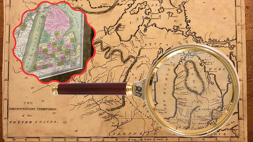
Don't count on this map to help you traverse the highways and byways of Michigan today, but this early representation of Michigan from an historic 1742 map does show the basic outline of the state.
The map was drawn by Joseph La France, son of a French fur trader who should be considered a native Michigander as he was born in Michilimackinac, or today's Straits of Mackinac region. La France explored inland routes between Quebec and Hudson Bay and west to Winnipeg. The 1742 map is the result of his journeys.
While the mitten-and-thumb shape is discernible from the map three are any outdated name and strange land forms present that look odd to us today.
For instance Lake Michigan is identified at Illinese Lake. Indeed Lake Illinois was an early name for Lake Michigan. Lake Erie is spelled Errie or called Conti Lake while Lake Ontario is identified at Lake Frontenoe.
Saginaw Bay is labeled Sakinac, which would rhyme with Saginaw. Fort St Joseph is located at present day Port Huron.
An oddity exists on the west shore of Lake Michigan with a body of water labelled Puants Lake for Green Bay. In fact Puants was an early name for Green Bay, the word means stinks in French, a reference to either the smell of the swamps in the area or the smell of the native Winnebago people. (Way to keep it classy, French explorers.)
The geography gets more odd looking at a very wide Upper Peninsula of Michigan and a Lake Superior that doesn't look so big after all. There are some odd islands in Lake Superior including a rather round Isle Royale and a mysterious island that certainly doesn't exist that might either be the legendary Copper Island or Isle Phelipeaux.
See the full map in the collection of the Beinecke Rare Book & Manuscript Library at Yale University.
BONUS VIDEOS - Moments of Michigan Nature
More From 107.7 WRKR-FM