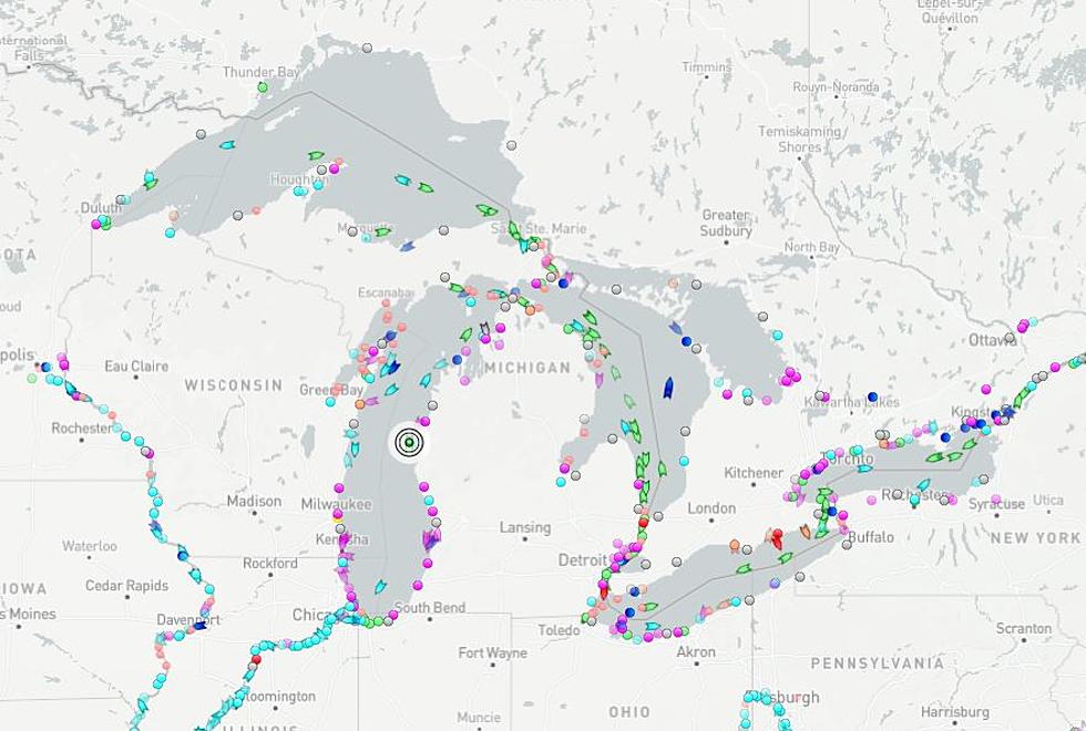
This Interactive Map Shows You All The Voyages Taking Place On Michigan’s Great Lakes
When you're out on the Great Lakes next summer, it may be helpful to check out a website I just discovered that not only allows you to plan your own voyage but to also see the voyages all major ships, carriers, and other large boats are making.
The site is marinetraffic.com and the interactive map shows every major ship of any kind anywhere in the world and where they're headed. On top of that, you can plan your own voyage and keep an eye on weather patterns as well, as they explain just how large of a reach they have:

MarineTraffic is the world’s leading provider of ship tracking and maritime intelligence. We are dedicated to making actionable information easily accessible. Monitoring vessel movements is at the core of what we do. Building on a base of data gathered from our network of coastal AIS-receiving stations, supplemented by satellite receivers, we apply algorithms and integrate complementary data sources to provide the shipping, trade and logistics industries with actionable insights into shipping activity. Our reach is truly global, enabling us to support the millions that use our service.
More Than Ships
Looking into this map, I see more than just ships, but also where there are large anchors placed, other water vessels & instruments, and other pleasure vehicles that are being used around Lake Michigan and all other lakes as well.
I've never used anything like this and I'm curious if the avid boater out there who's from Michigan uses this tool. There is apparently an app for it as well.
This Stunning 1850's Northern Michigan Airbnb Is An Old Lighthouse
The Old Presque Isle Lighthouse
More From 107.7 WRKR-FM